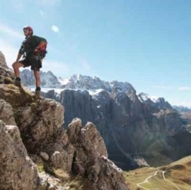
Virtual Peak Bagging
With this Virtual Peak Bagging Resource, you can now explore online all the Scottish 4000s, all the Munros and all the 3,000 ft peaks in England and Wales (Furths). We may then provide the same facility for all the 2,000 ft peaks in England and Wales (Hewitts), but only if this project attracts sufficient interest as measured by page hits. If you like what we have done, then please make extensive use of it and tell others about it or place links to some of its pages in your social media posts or repost our webmaster's posts about it on X/Twitter (@CasegFraith), if you have an account. If you have a website, then placing links to this page on it will greatly improve our Google ranking. More people will then be able to enjoy exploring the mountains without leaving their homes.
To start virtual peak bagging, select one of the links below:
| Munro List | Munro Map |
| Scottish 4000s List | Scottish 4000s Map |
| English 3000s List | English 3000s Map |
| Welish 3000s List | Welsh 3000s Map |
| English Hills | Scottish Hills | Welsh Hills |
You will be able to view an embedded 360° panorama (which Google calls a Photo Sphere) taken near the summit by a Street View Local Guide and then uploaded to Google Maps. You can also learn some interesting facts about the mountain and how it got its name. You will be able to learn more about the mountain by a link to its entry in Wikipedia and view a small map and read about the the walking routes on the mountain from a link to the Walkhighlands website.
The Walkhighlands website also has a line-drawn panoramic summit view that might help you identify some of the peaks you can see in the 360° panorama. For the Munros, there is also a button to press to hear the correct pronunciation. Sadly, this feature does not exist for the English and Welsh 3000s.
>There will also be a link to view the mountain from above on Google Earth. It should be noted that Google Earth will not be accessible from all browsers and if it will not open, then try it again with Google's Chrome brower. Please also note that the markers that Google have for mountains are not always in exactly the right places for the summits. To view the whole 360° panorama, just hold down the mouse button and move it across the screen in the direction you wish to see or use a finger if you have a touch-sensitive screen.
For the Munros, some extra information is available and also more links for Ordnance Survey maps at 1:50K and 1:25K, an OpenStreetmap topographical layer map, a geology map, a photo gallery and a link to the mountain's entry on the Hillbagging website).
You can learn more about the various, and sometomes confusing, classifications of mountains from the Scottish Hills, English Hills and Welsh Hills pages. These pages are also accessible from the side menu on our Acknowledgements and About Virtual Peak Bagging pages.
Finally, you can also enjoy a virtual hill walk on a mountain in Google Maps with Street View. To learn more about this and then view the summits that you can virtually walk on, pleaee click on Virtual Hill Walking.
Published on