Welsh 3000s - South
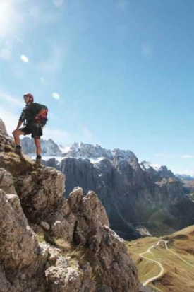
There are eight Furths in this group, south of the Ogwen Valley or west of the Nant Francon Valley. There are three in the Snowdon Massif and five in the Glyderau (the plural of Glyder) Range. English speakers often refer to this range as the Glyders, but this is incorrect, as it mixes two languages. Strangely, they don't do this with the Carneddau by calling them the Carnedds! Both of these areas contain very rugged and rocky peaks and hence offer great rock cliimbing, scrambling and walking and, as a result, they are very popular with both climbers and walkers. In keeping with our south to north virtual peak bagging for Wales and England, we have ordered them accordingly below.
Wyddfâu Range / Snowdon Massif
Glyderau Range
Routes
The link to the Walkhighlands entry for each mountain provides descriptions and maps of walking routes. Many also have GPX routes that you can download to a GPS device. Additionally, Google Maps have filmed some hill walking routes on Snowdon for Street View. Details of how to take virtual hill walks on Snowdon and other peaks can be found on Virtual Hill Walks - Wales.
Videos
For videos showing different activities on some of these moutains, click on a link below:
Published on